New Trail & Old Ghosts
Birdie and I keep making new discoveries and gosh do we love the options we found around Lake Springfield. First, a reminder of who I am and why we’re doing this series on area trails. As the webmaster and testimonial producer here at Professional Weight Management, I’ve been keenly aware how important exercise is to any weight loss program. And since walking is one of the easiest exercises to fit into a busy life, that’s become our go-to recommendation. We just don’t want circling the same suburban blocks to get so boring that you quit, so we’re spotlighting new paths that are adaptable to any fitness level and close to where you live. Apologies to our Branson friends that we haven’t hiked those trails yet, but they’re coming soon!
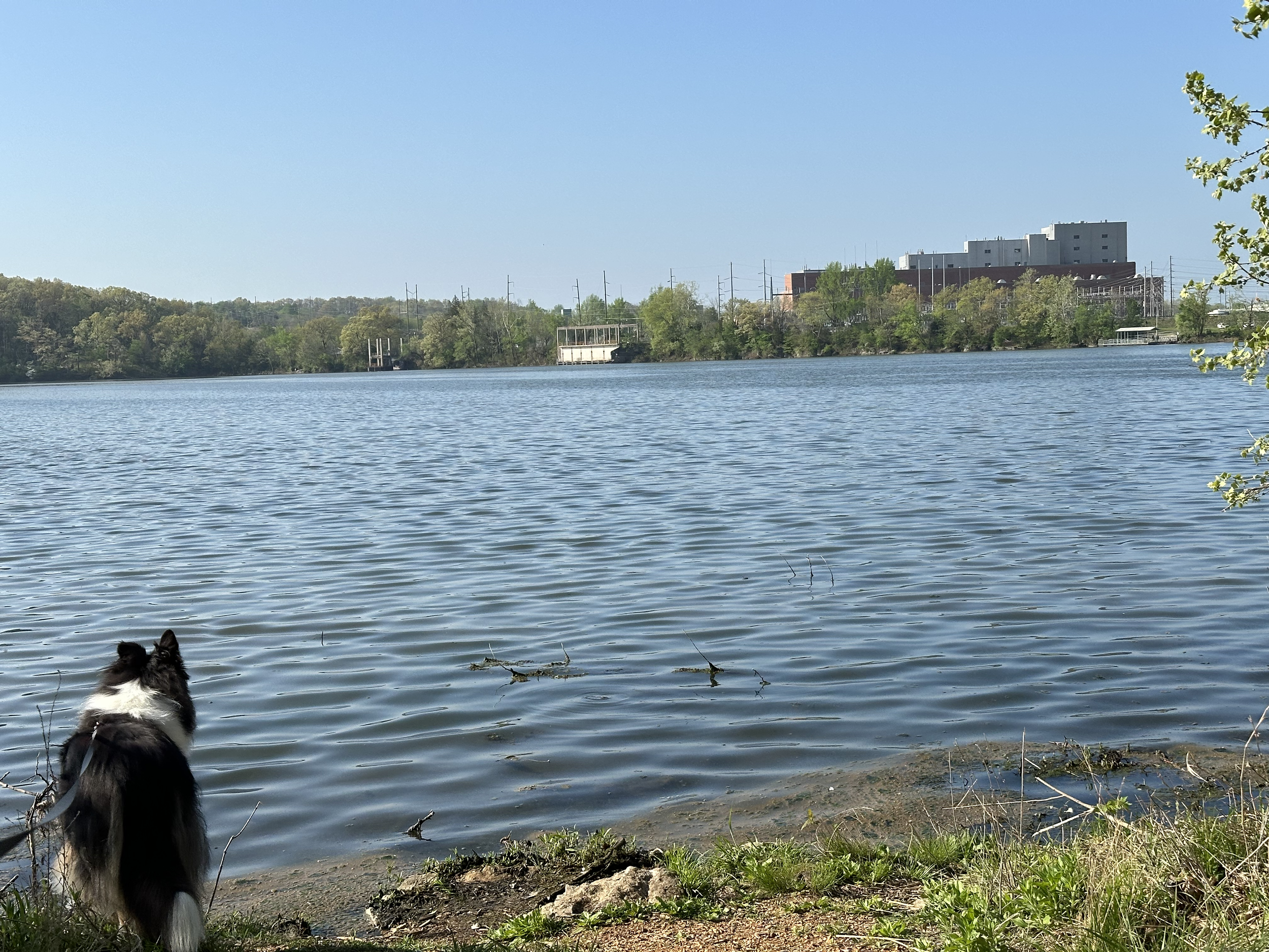
Now, back to the trails around Lake Springfield. You’ll have your choice of several parking lots that adjoin the paved James River Greenway but we recommend parking at the Boat House, where you’ll find toilets, a water fountain and a small shop, along with the opportunity to rent a boat if you want to get out on the water. From there you can follow a paved trail along the lake until it starts a steep climb to the Kissick Road lot. Either turn around and come back by the same easy trail for a roughly two mile hike or follow the signs north and start up a wood chip trail for a 2.2 mile loop through rough, forested terrain.
Here’s the paved section:
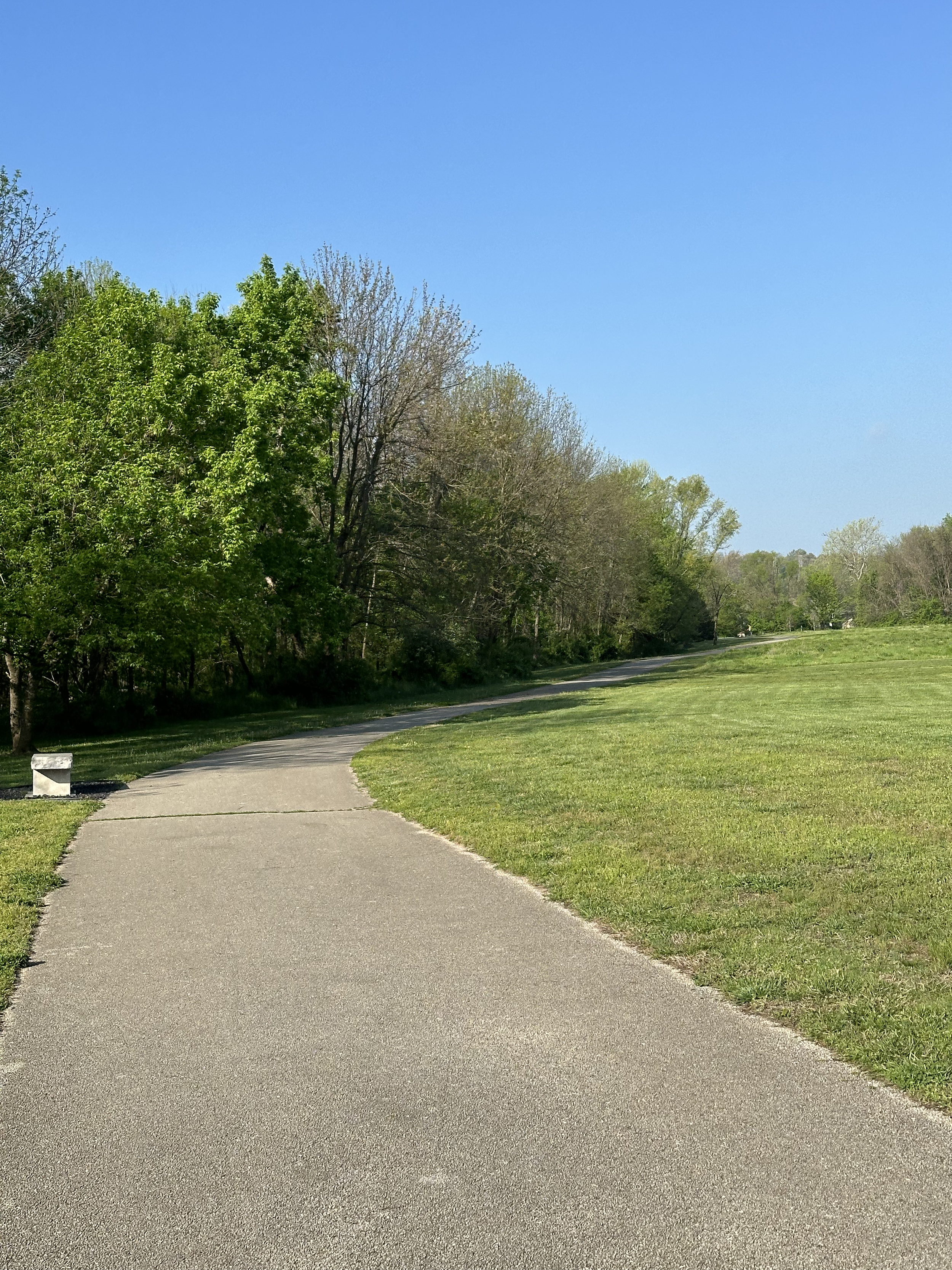
Paved Lake Springfield trail
Easy, level terrain and wheelchair accessible
And next is the chip wood (or rock) trail:
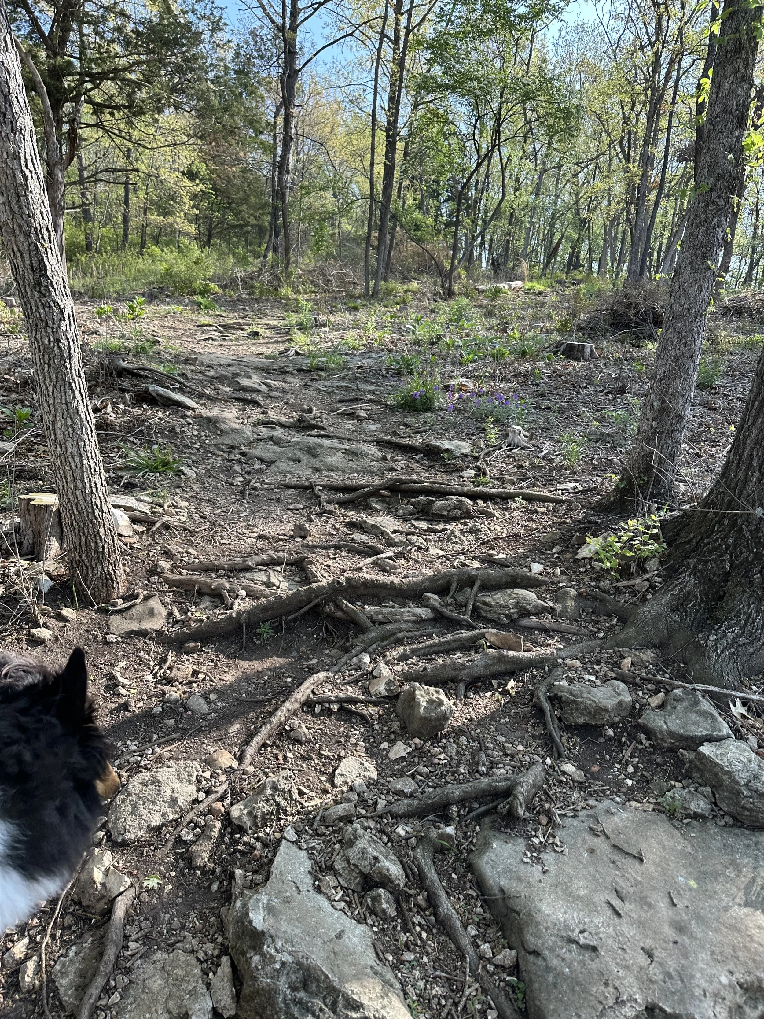
Unpaved chipwood trail
Rocky, shaded and more challenging than the paved trail. Definitely not wheelchair accessible.
And if you want to identify those trails before you set off, below is the map from the Springfield-Greene County parks:

Map from Springfield-Greene County parks
Birdie and I enjoyed both trails but loved the rocky trail. There were so many squirrels and lizards to try to chase that she stayed on constant alert, while I got to feel like a kid scrambling over rocks. Our walk was on a particularly warm morning, which highlighted how welcome the shade will be when things really start heating up. A few words of advice for hiking a rocky trail though:
The trail isn’t always obvious. It’s true that I’m notoriously navigation impaired, so it’s no surprise that I took a wrong turn or two but the trail reviews on my Alltrails app proved I’m not the only one who got a little lost. So I once again recommend AllTrails or a good map. No worries if you do get lost though, as you’re really never far from a road or the lake and can easily reorient yourself. And getting a little lost can add steps to your daily count, which is never a bad thing, right?
Wear good shoes. As the day was warm, I’d switched from my hiking boots to a lighter, more airy hiking sandal, and if you do the same then just make sure your footwear has a closed toe/heel and good traction. My sandals saved me from a sore toe when I accidentally kicked a rock while admiring a pretty woodpecker, and the good traction gave me more confidence at the wet slick spots.
Consider waterproof shoes. The paved trail had one short segment that crossed a water runoff, which was dry when we were there but was signed as dangerous when water was present. Never walk into a current, as even a few inches of swiftly moving water can be risky, but this is spring and rain puddles won’t dry up fast on the shaded unpaved trail.
Two more tips for the coming high temps:
Bring water. Yes, we know that you know how important water is but it’s worth repeating—take a water bottle! Even if you think you’ll be fine without it, your body will heat up with the exercise, the hike can take longer than you thought it would, and the weatherman may have misjudged just how warm it was going to get. I know what I’m talking about because I forgot to carry water on our Lake Springfield hike and thought the collie would never stop lapping up water when we got back to the car.
Wear a hat. Mine is a big floppy thing to save my ears from frying in the sun. Hats will keep your head cooler, protect you from sunburn, and offer some protection in an unexpected spring rain. Besides, I bet you look awesome in a hat!
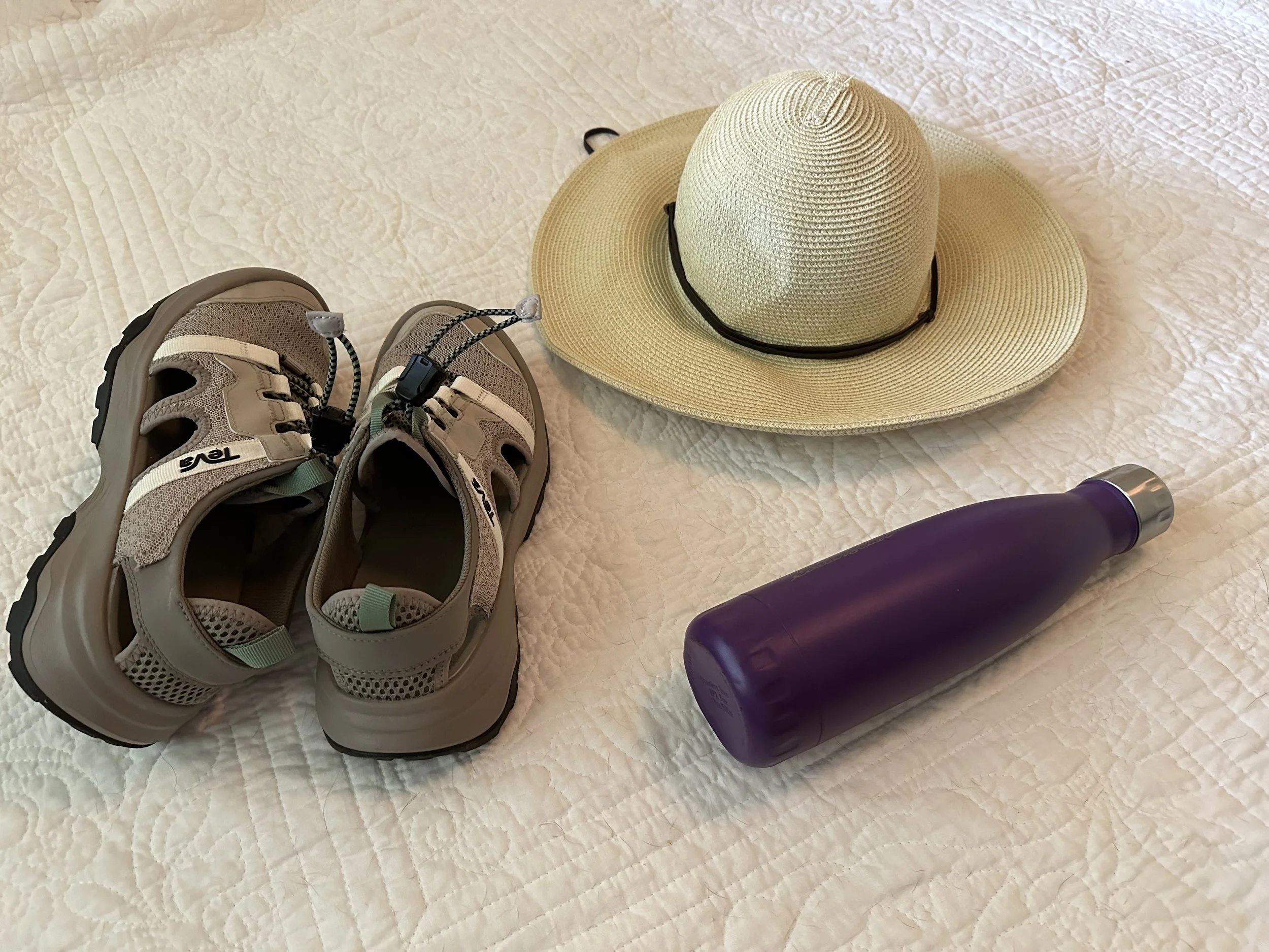
I bought the hat in Palm Beach for WAY too much money but it’s light with a shady, wide brim. The Teva hiking sandals are new and were completely comfortable straight out of the box.
Oh, did I promise a new trail and old ghosts in the headline? Let me tell you about the Chadwick Flyer Trail. It’s sorta connected to the Lake Springfield trail but I don’t think the connections exist yet and have no idea where you’re even supposed to park for the Chadwick Flyer. So we didn’t hike it this time, but with a James River section of it (west of the old Lake Springfield power plant) opening only a month or two ago, I’m counting it as a new trail. And boy does this section have some history.
First, the trail itself. Here’s a link to the Ozark Greenways website description with a map of the current and planned sections, and the section close to Lake Springfield is a wide paved path bordering the James River. It’s built on the old railroad tracks left behind by the Chadwick Flyer rail line from Springfield to Chadwick, and we found it shortly after its opening while on the hunt for Camp Cora.
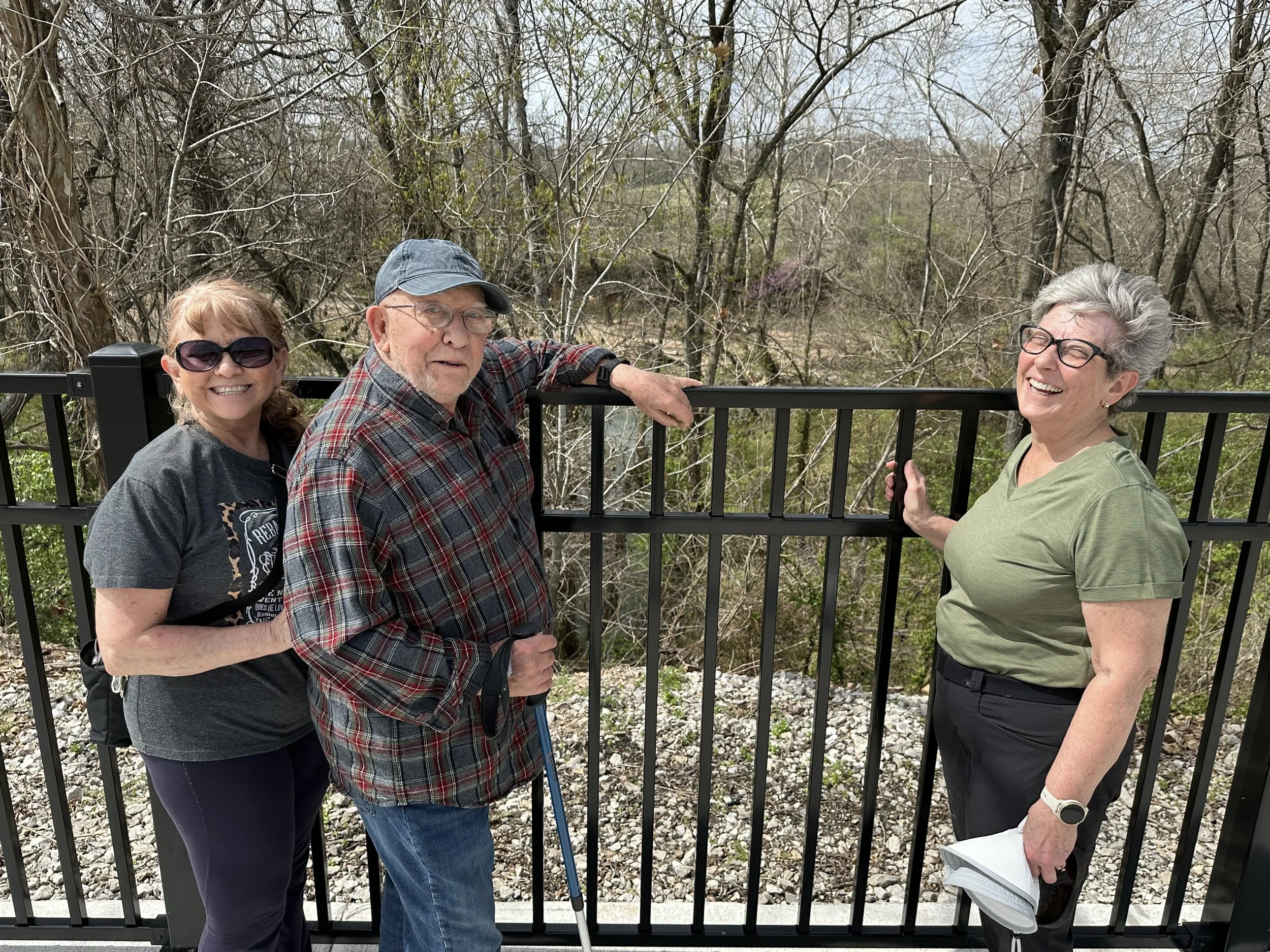
What’s Camp Cora? Every time we’d try to get my 90 year-old dad out of the house, he’d tell us that he’d go except nobody has offered to take him to Camp Cora. He calls it “the most romantic spot in the Ozarks” and says it’s one of the spots he fished when he was young. Plus I suspect it’s one of the spots he romanced my mother when she was also young. The problem is that none of us knew how to find Camp Cora, but he had the old directions in his head and on Easter Sunday my sisters and I set out with him to try to retrofit his old directions into today’s much changed landscape.
First, we had to turn right on a road just past the now-closed Lake Springfield power plant. That road was also closed and blocked, so on we went to the next right turn and kept turning right until we were as close as we could get to James River. The road had some grassy pull-offs where we could park and just on the other side of the grass was the new paved trail, which didn’t even exist yet on my trail maps. It didn’t take long to find Dad’s old blacktop road, unused but still visible passing under the railroad overpass. Dad had told us the road curved just past an overpass. We were getting closer. So back we went to Dad and, after studying the map for a wide spot in the river where an island could have been (yes, there was supposed to be an island), we were off on the hunt again. And my sister found it!
Just off the paved trail and hidden in the trees, there are manmade rock steps descending to the river. We actually found a 100 year-old survey stone next to the steps, and at the bottom of the steep climb we found the cool spring waters pouring into the James from the Camp Cora caves. Doesn’t it look like a refreshing place to hang out on a hot summer day?
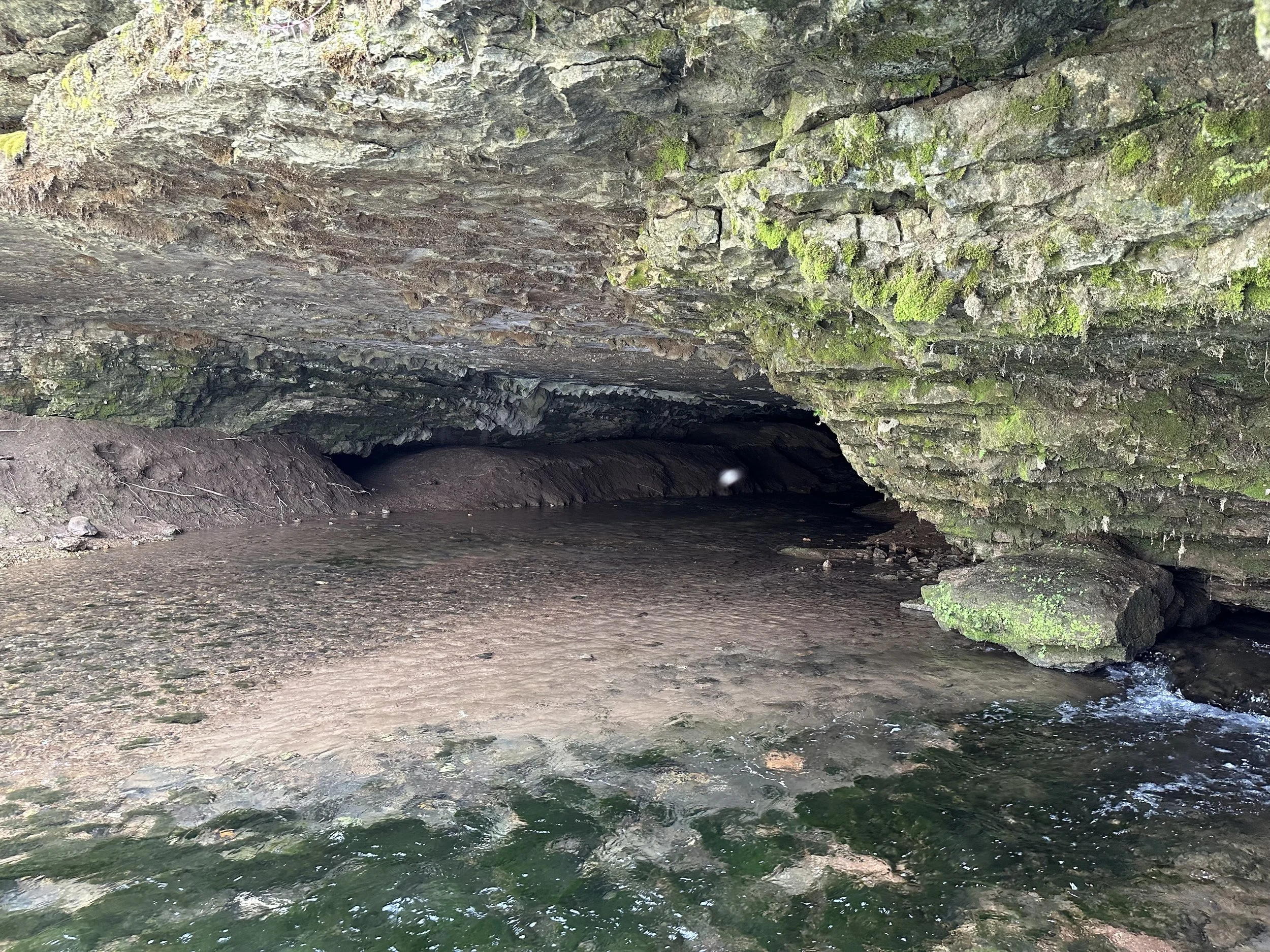
The cave and springs of Camp Cora. A cool place to spend a summer day in the days of long ago.
And before the lake changed the river, the scrubby land splitting the river was probably a lovely little island.

There was an island here once but now it’s more of a shadow of its glory days
Back in the day, and we’re talking the 1880s thru the early 1900s, Camp Cora was a wildly popular summer destination. Whole churches would charter the train to take their congregation there for a Sunday picnic. Young people would camp for days. In August, 1894, a Springfield Leader & Press reporter wrote of one encamped party:
“All the ladies were dressed in beautiful summer costume and appeared to be cool and comfortable. Miss Anita Campbell was especially delicious to look upon, arrayed in some airy material, as she disported herself in a hammock surrounded by a delegation of admiring young gentlemen with fans. If was a sight long to be remembered, and the disciple of the press as was helpless as the rest of the army of insects that hovered around, though he managed to capture a boat load of turtles and other good things to eat.”
No wonder my dad calls it the most romantic spot in the Ozarks. Here’s more from June, 1886:
“A party of our society folks are busy arranging for a two week’s encampment at Camp Cora. There will be about 30 in the party, which will move upon the works heavily laden with commissary supplies July 10. Among the rules of the camp is that no gentleman shall shave during the encampment. The rule of the ladies is that each shall bring a hammock. Ed S. Finch will be commander-in-chief of the party.”
Oh, to have been around during those days and to have been one of the ladies in the hammocks. In the meantime, you can have the grand adventure of finding the steps down to Camp Cora just off the Chadwick Flyer trail and imagining the ghosts of those ladies in their airy materials. I have the GPS coordinates if you need them. And here’s a picture of Dad and my sisters taken just moments after our victory:
May you enjoy your adventures as much as we did Easter afternoon.
Have a great hike!