Hiking Thru History at Wilson’s Creek National Battlefield
How lucky are we to live in the Ozarks? Not only are our Ozarks Mountains lovely to look on from the road, but they’re even better on the trail, where the paths follow tumbling creeks or scramble up through the dogwoods and the oaks to wide meadows. They are neither as death defying as a Rockies climb or as easy as a Kansas flatland stroll. An Ozarks trail makes us work for our daily steps quota, but not too hard, and the reward is lots of fresh air, plenty of nature, and, at Wilson’s Creek National Battlefield, a ton of history to enliven your hike. Even better, if you live in the Springfield MO area, Wilson’s Creek is practically in your own backyard.
Or at least it’s practically in my backyard. While most of the articles in the Professional Weight Management blog are informative but not personal, this one is purely from my point of view. I’m Karen, the webmaster, which is an awfully fancy term for someone who keeps the website up-to-date, and I’m fortunate enough to be semi-retired at the age of 67, which gives me time for long hikes with my one year-old collie, Birdie. I highly recommend a one year-old collie for anyone trying to commit to a walking routine. There’s nothing like a four mile hike to turn a hyper pup into a good dog, so Birdie forces me and my lazy body to get up and move.
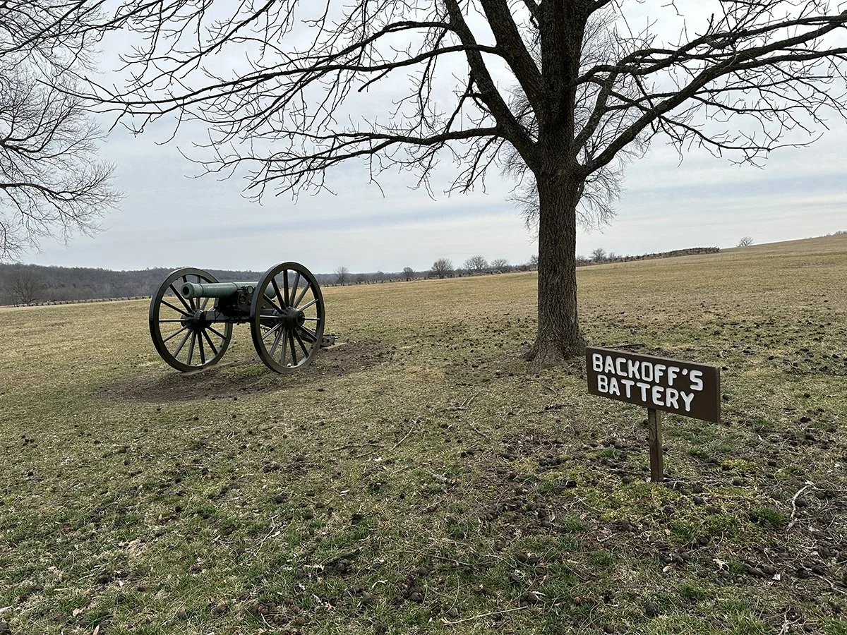
And my favorite place to move is Wilson’s Creek. For those who don’t know, Wilson’s Creek is a national park honoring the historic sites of the Battle of Wilson’s Creek, 1861’s most significant battle west of the Mississippi. While the Confederates technically won the day and temporary control of SW Missouri, losses were heavy and left a section of the park aptly named “Bloody Hill”.
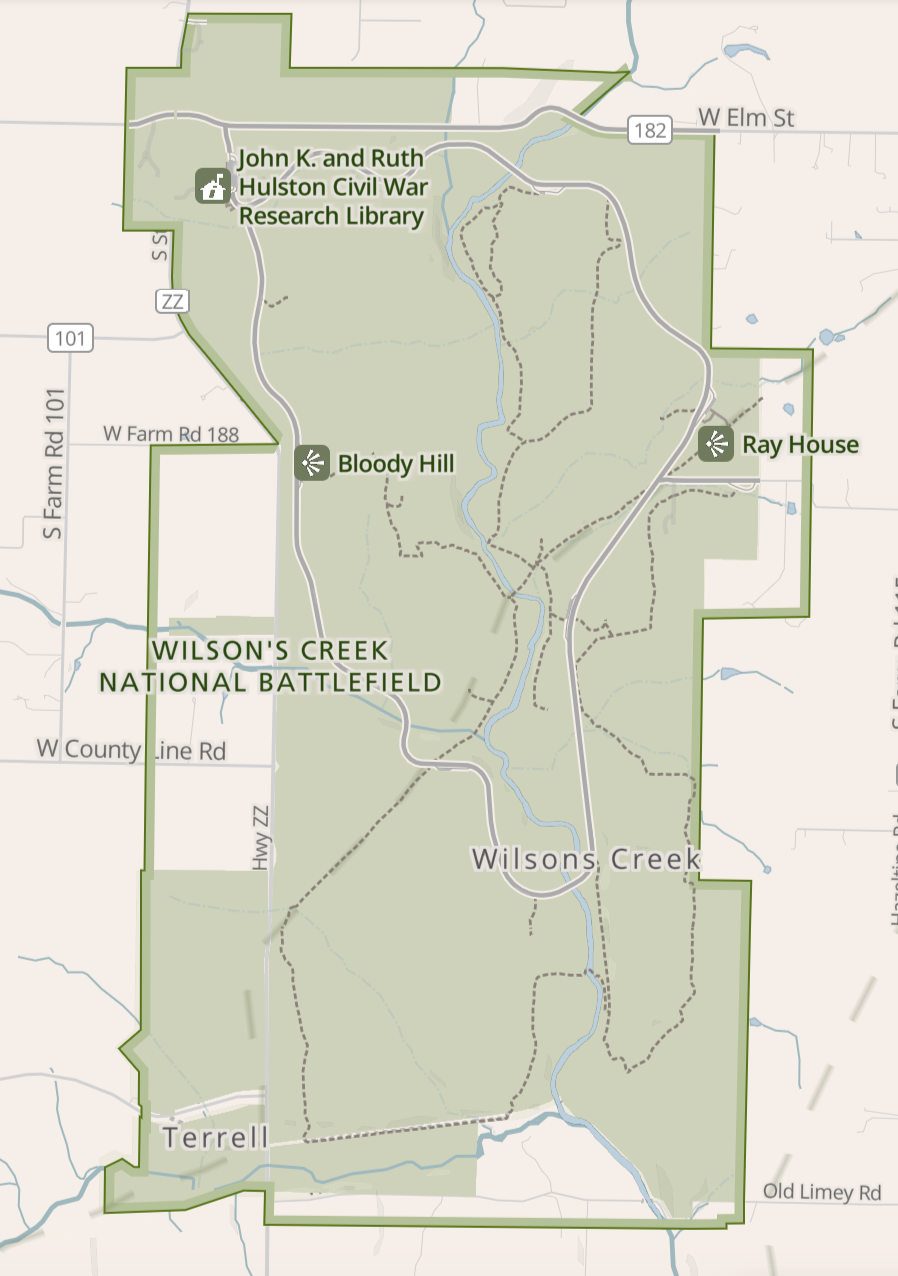
The park is roughly circled by a 4.9 mile one-way road edged with a wide walking path. That path is popular with hikers and bikers, although I frequently see the bikers dismount to walk their bikes up the steeper sections. Most of the hiking trails are contained within the circle road but some cross outside its boundaries. The trail map provided on at the battlefield’s website looks like this:
Most of the park’s visitors can find they way around with only that map in hand, but I am navigationally challenged and I get lost—a lot. So after testing the AllTrails app (available for both Apple and Android) during its free trial, I paid the $35.99 for a year’s use. What I like about it is:
A search function to find trails near me or anywhere in the US.
Trail maps, difficulty ratings, and reviews. The reviews often offer a head’s up about challenges such water crossings or steep sections, which aid in choosing which trail to attempt.
GPS and the ability to download maps if cellular service is spotty. I can open the app anytime to see exactly where I am on the trail or where I took a wrong turn and wandered off the trail. I can also adjust the trail by finding a shortcut back to my car or a detour if I want to add a mile or two to my hike.
Distance logging. For whatever reason, I trust AllTrails more than my Apple devices to accurately chart the distance I have hiked.
If you don’t want to use AllTrails, then your Apple Watch or cell phone probably has a built-in GPS and a step logging function but they won’t warn you about challenges on the trail. Like this low water crossing at Wilson’s Creek:

Beautiful, isn’t it? It was my collie’s first water crossing and, even though the water was only a few inches deep, Birdie was convinced I was trying to kill her. I had to slowly and gently drag her across. We came back over the same crossing and this time I gave her a treat before leading her into the water, which seemed to do the trick. She waded right in but got too close to the edge and I had to haul her back from sliding down into the waterfall. Boy, was that exciting for her. She got the zoomies when we hit dry ground and kept sprinting back and forth as far as her extendable leash would take her. What a goof.
As Birdie discovered, hiking the trails isn’t quite the same as walking a city park path, and along with carrying a navigational aid it is wise to wear waterproof boots with good non-slip tread. Even if you don’t have to cross a stream, you may hit muddy, steep trail sections that can become dangerously slippery without the right footwear. Boots also have the advantage of offering excellent support to reduce strain on your knees and back. Through the decades, I’ve collected far more pairs of hiking boots than I’d like to admit, but here in the Ozarks the rest are left in my closet while I hike in my Ariat Terrain Waterproof boots.

These boots are perfect for me because they’re fairly light, they keep my feet dry in a few inches of water, and they fit perfectly. Are they the right boot for you? There’s no way of knowing which boot fits your feet until you try them on, but thankfully we are blessed here in the Ozarks with good outdoor footwear stores. I recommend Bass Pro but if they don’t have anything that suits you then Zappos.com is also great for amazing selection and free returns if a shoe doesn’t fit.
You can find walks and hikes of nearly any length at Wilson’s Creek. AllTrails lists six trails of four+ miles but those can be linked together to create a much longer hike or cut shorter with a detour or a hike in/hike out route. And again, the AllTrails app is your friend if you want to readjust your route on the fly.
If this is your first visit, I recommend starting with the .8 mi Gibson’s Mill Trail, which follows a stream to the well-marked site of a now gone mill. Enjoy imagining yourself as an 1860s farmer leading a mule loaded with bags of corn to the mill, then lose the illusion with a loop back through the trees to the start of the trail. Or don’t make the loop and keep going to the Wire Road, another well-traveled path during its day. The Gibson Mill Trail is the most popular starting point at Wilson’s Creek and you’ll get plenty of friendly smiles and greetings from family groups also enjoying the trail, which can be comforting for women hiking solo. You will rarely feel alone.
For another easy and short but historic walk, you can’t beat the Ray House. This home became a war hospital during the battle and is still standing. It sits just up a steep hill from the parking lot but there are steps to safely ascend the hill. You can also walk down the hill to the rock cellar where the children hid at that start of the battle. This stop is popular with families but it’s also an excellent starting point for much longer hikes. Just check the map and choose the path you want to take.
Watch for more trail reviews in future posts, and if you see this dog out on the trail, say hi to Birdie.
Have a great hike!